Madagascar to Mozambique

Morumba Bay – point of departure from Madagascar
If the sail from the Seychelles to Madagascar was an exercise in physical stamina and endurance the trip from Madagascar to South Africa was a test of mental stability edging towards insanity.
The stretch of water I refer to lies between 15 and 25 degrees of south latitude and between the east coast of Mozambique and the west coast of Madagascar. Most waters of the world in these latitudes usually offer gentle sailing, consistent winds and generally pleasant experiences. However, the Mozambique Channel offers a number of challenges and sailors are wary of these waters especially south of 20 degrees south latitude.
The group of sailors who have moved across the Indian Ocean this season are a cautious lot and as with many sailors leaving for a crossing there are a great number of conversations about weather and tactics.
Modern technologies and access to weather sites are numerous. Most weather sites use grib files to make predictions for future wind patterns. These are great guides to sailors planning an ocean crossing but they are fallible. As I write the prediction for our particular location calls for south-east winds of 10-12 knots but we have 12-15 knots of north-west wind! Not to belittle the grib but it’s best to understand they are built on models and love it or hate it nature always tends to surprise us.
Well, the Mozambique channel was a surprise. We made our departure a day after two or three boats making the same passage, Morumba Bay, Madagascar to Richard’s Bay, South Africa. The grib files showed southerly winds but the channel was a few days sail away and first was getting off the coast of Madagascar to turn south.
The winds along and close to Madagascar near Morumba Bay follow a daily pattern of easterly winds in the late evening until early morning turning to westerly during the late morning as the land mass heats up. Getting off the coast and into open water is a matter of timing so we left in the early hours of the morning and by late evening we were clear of shallow water and out in the open ocean. Great, step one accomplished.
In the meantime one can listen to boats on passage by tuning in to a scheduled radio broadcast twice a day. Again modern technologies are in play as people continue to download grib files and watch the weather. Most interesting and telling for us is to listen to the position reports of other boats. At this time of the year there are usually 10-15 boats participating in the broadcast and they are scattered throughout the Mozambique Channel and the stretch of water from Reunion to South Africa.
Our main struggle became the adverse current at play. Sailing south became a cat and mouse game with the current, and, we lost many times. The contrary current mixed with southerly winds was a deadly combination. Just trying to make forward progress became a mental challenge to a boat and crew used to making good 120+ miles to a destination. There were days where forward progress was hard-fought against headwinds resulting in daily runs that amounted to 60 miles!
It soon became apparent we needed a break. With a storm forecast to be overhead in a few days

Hiding from the coming storm
we headed towards Bazaruto. Bazaruto is a large bay on the east coast of Mozambique.

Bazaruto National Park
It’s a stunningly huge bay protected from the ocean with sand dunes rising 250 metres.
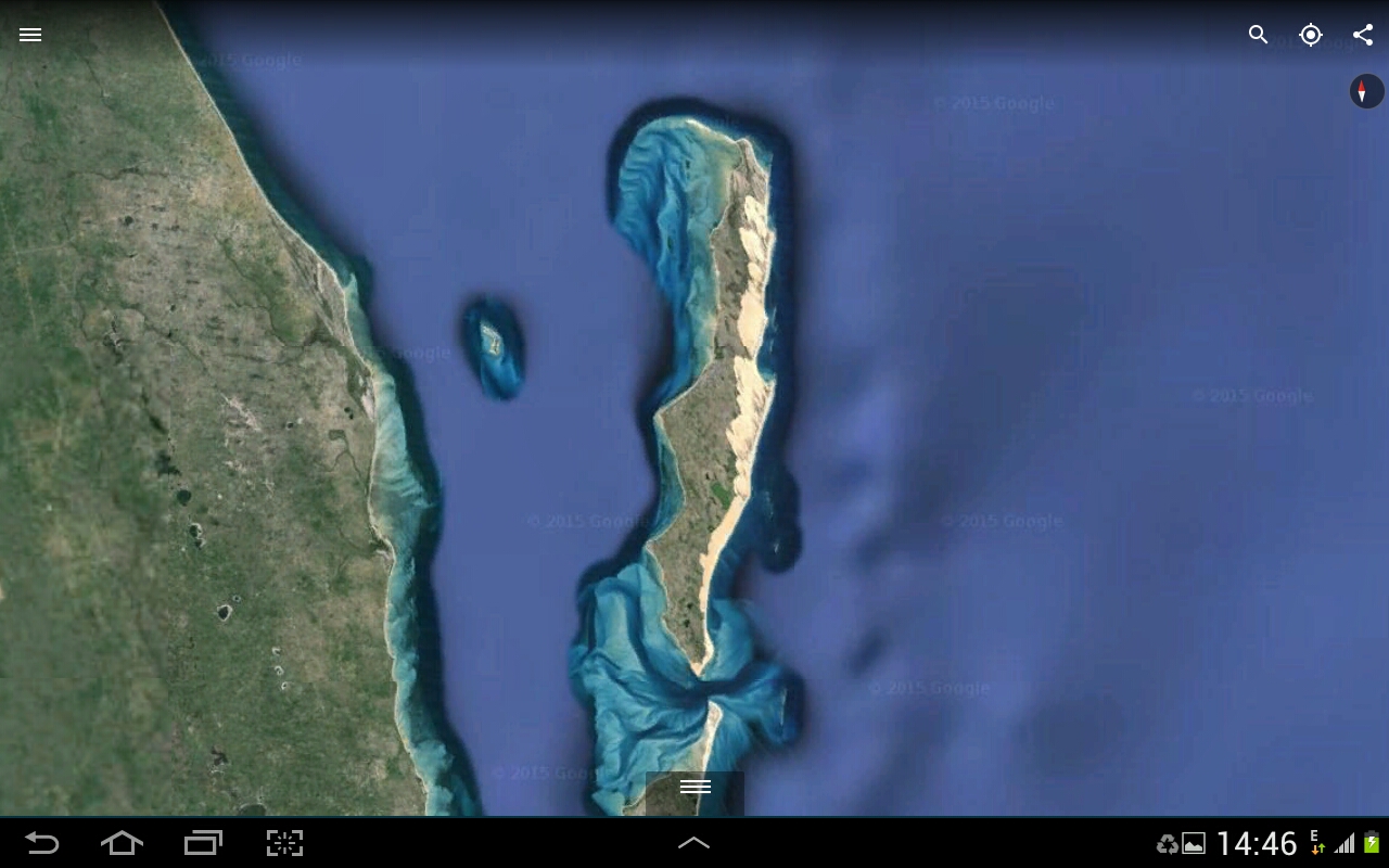
Ilha do Bazaruto
The bay is shallow with numerous sandbars but with careful navigation one can maneuver into anchorages none of which offer 360 degree protection. However, we did find a location which in the end accommodated 8 other sailing yachts each seeking shelter from the storm.

Under tow by Crystal Blues in Bazaruto Bay. This is another story
Leaving Bazaruto was a real nail biter. An uncertain engine, an incoming tide, a storm swell, a shallow (2.5 metre) bar with breaking waves to manoeuvre and 8 boats leaving at the same time made for some tense moments. We made it through and headed south with an ever-increasing wind from, can you believe it, the east and shifting north-east. Yahoo, and on top of the good wind direction over the next two days we caught the occasional exhilaration of a current that moved south at upwards of 4 knots. We thought we were home free.
55 miles from Richards Bay the wind died, the motor broke down and for the third time in two months we were towed into port. This time though we sailed to within 6 miles of Richards Bay. We were within VHF contact of cruising friends and support from the local volunteer organization here called the NSRI, National Sea Rescue Institute.
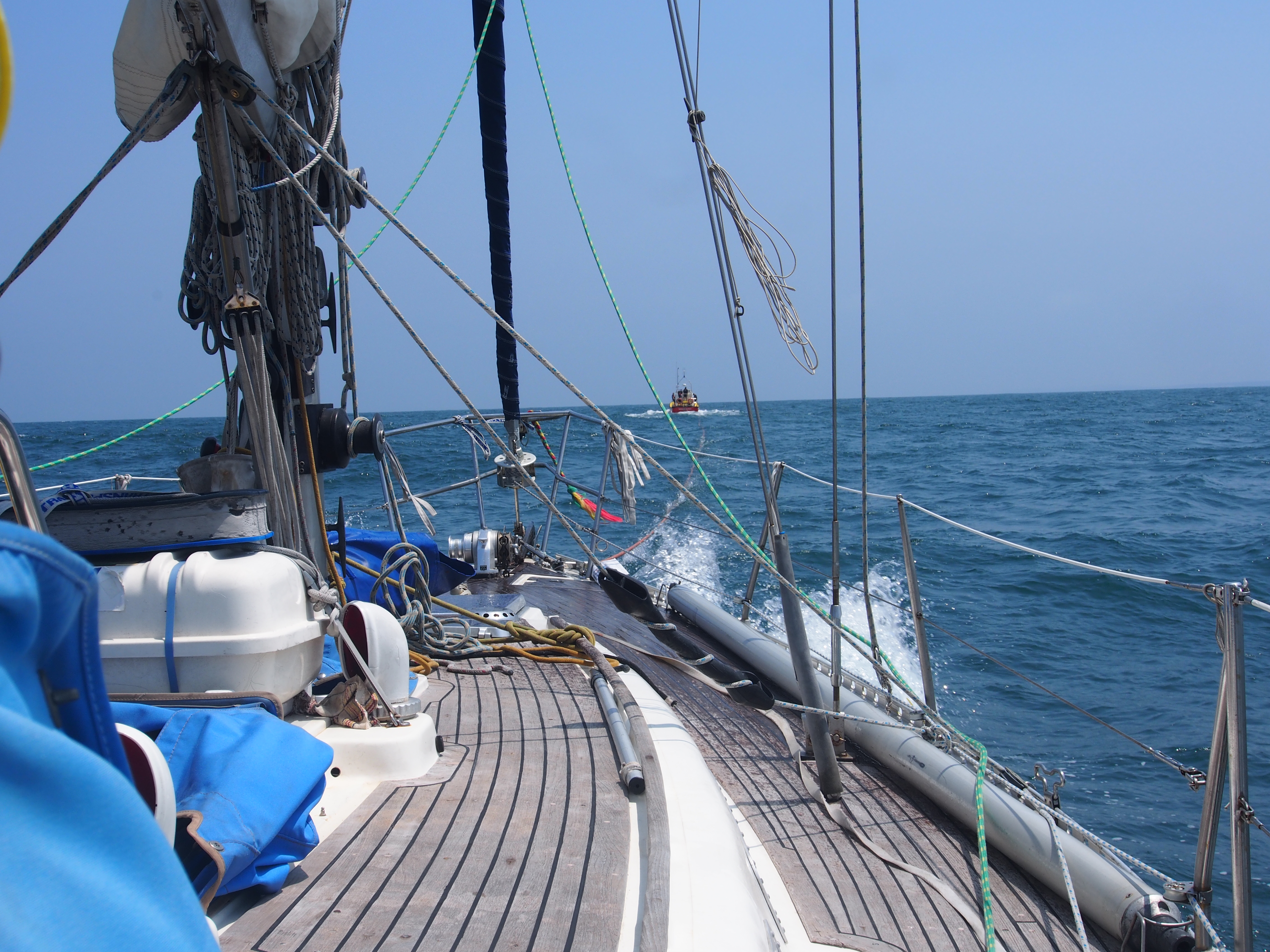
Under tow at 6.5 knots and all to windward

towing bridle
They needed some practice, put a team together and within a few hours we were comfortably tied up to the dock in Richards Bay and collapsed.

Loved this one… dear God keep at it because I never will.. am enjoying Jerusalem. Exciting and safer than your patch old mate! Keep it coming, eh.
Oh dear – quite the ignominious entry to Richard’s Bay. However safe in port is safe in port, thankfully. Enjoy your visit there. When we arrived there we had to take the head of our engine and have work done on it – there are good engineers to be found there. Be safe. We stayed some time there, hired a car a few times and visited the game parks – awesome experience.
Wow, you two are tough. It has to get easier from here. We anxiously await further updates. Wishing you good luck and improved conditions. Warmest regards, Loretta and Darrel.
Glad you are safe. Was wondering how you are doing. We are home until February 29th. Spending winter here rather then on the boat in Ipswich. Getting some work done on the rigging and new sails. Apparently they don’t last forever. Stay safe and enjoy South Africa.
Ever onward toward the westing sun. When you get to
East London, let me know, I’ll be able to hook you up with some excellent technical support. That’s the community that gave Michel’s sister so much help.
Best, Fred
Glad to hear from you . Was begining to get worried
All the best from Saissac / France
I can just see you and Connie looking at each other in the eye, thinking, ‘here we go again’ but secretly each wanting to scream…..TONY !!!!!!!!! Or …….CONNIE !!!!!!!!! Your trials and tribulations make my issues relatively small.
Connie/Scott – Have you heard from Dave and Marcia since they left Madagascar? I’m a friend in Seattle and two days ago (Nov12th) I got an automated email from their inmarsat sat phone with a lat/lon (it was out in the ocean between Madagascar and Mozambique).
Any info or suggestions?
Thanks for any help – Tod Christensen (I met you at their condo a few years ago)
OMG
Sounds dreadful!
I would have jumped over board a LONG time ago!
We are off tomorrow for Mexico.. will return on March 15th/16.
It will be smoother sailing than you have had I know for a fact!!!!!!!!
hasta luego,
Annie B ad Lornie D.
We’re glad to read that you arrived safe and sound. Will you be staying in Richards Bay for awhile or heading around the Cape?